By Kevin McGill, Stacey Plaisance, and Rebecca Santana
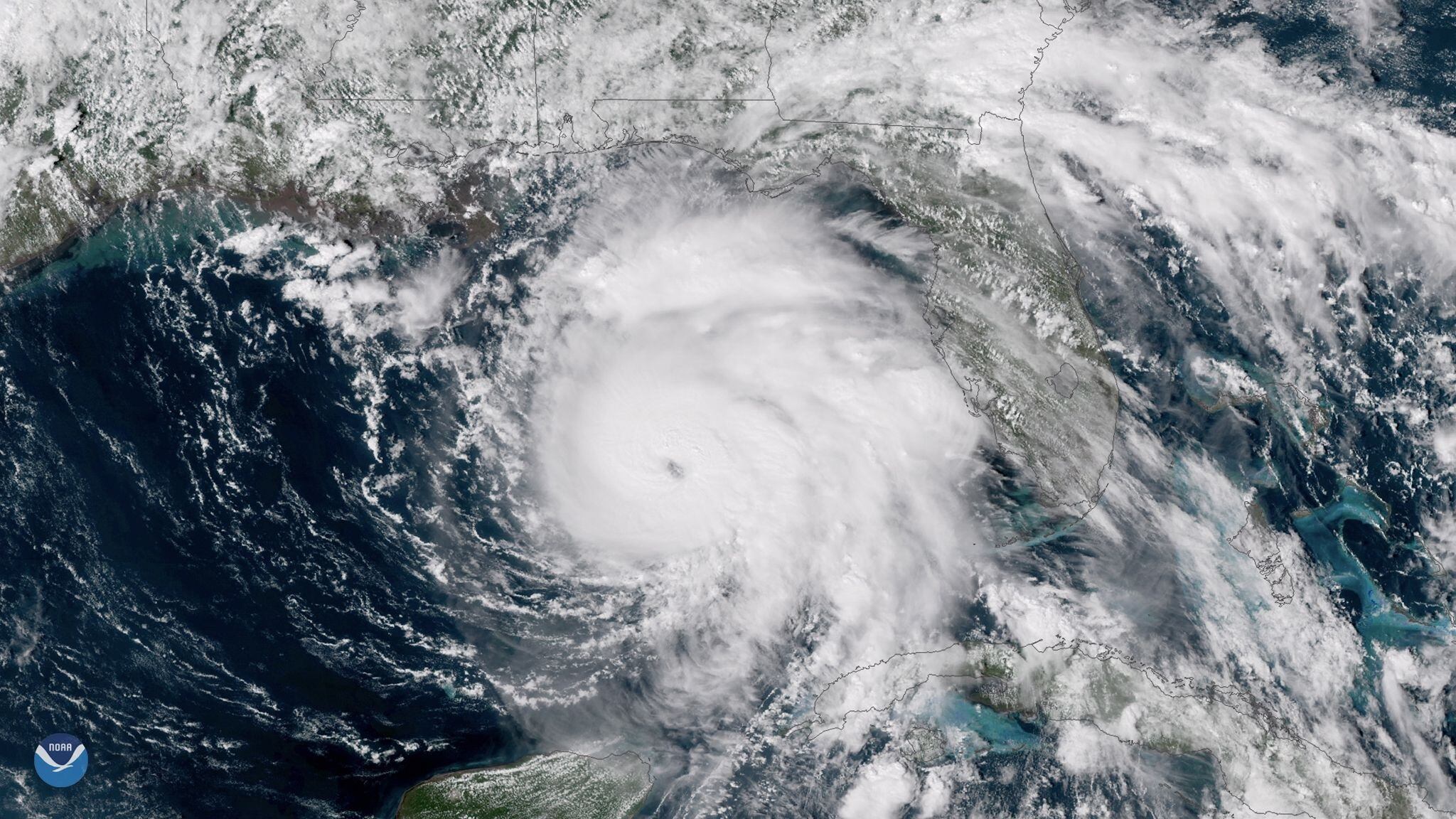
Hurricane Zeta slammed into storm-weary Louisiana on Wednesday with New Orleans squarely in its path, threatening to push up to 9 feet of sea water inland and batter homes and businesses with fierce winds in a Gulf Coast region already pounded by multiple storms this year.
Some roads were flooded near the coast, where forecasters said Zeta was making landfall around Terrebone Bay near Cocodrie, an unincorporated fishing village at the end of a highway.
Rain pelted the French Quarter in New Orleans, and streams of water ran off roofs. Trees whipped back and forth in the wind, though a few people were still out on Bourbon Street with umbrellas or in slow-moving cars. The iconic streetcars were idled and City Hall closed, Mayor LaToya Cantrell said.
Zeta had top sustained winds of 110 (177 kph) as a Category 2 hurricane and was the 27th named storm of a historically busy Atlantic hurricane season — with over a month left before it ends.
Tropical storm warnings were issued as far away as the north Georgia mountains, highly unusual for the region. New Orleans has been in the warning areas of seven previous storms that veered east or west this season. Zeta was staying on course.
“I don’t think we’re going to be as lucky with this one,” city emergency director Collin Arnold said.
Zeta had been predicted to hit as a relatively weak Category 1 hurricane, but Louisiana residents awoke to updated forecasts predicting a Category 2 at landfall around the southeastern part of the state.
“The good news for us — and look, you take good news where you can find it — the storm’s forward speed is 17 mph. That’s projected to increase, and so it’s going to get in and out of the area relatively quickly, and then we’re going to be able to assess the damage more quickly,” Gov. John Bel Edwards said in an interview on The Weather Channel.
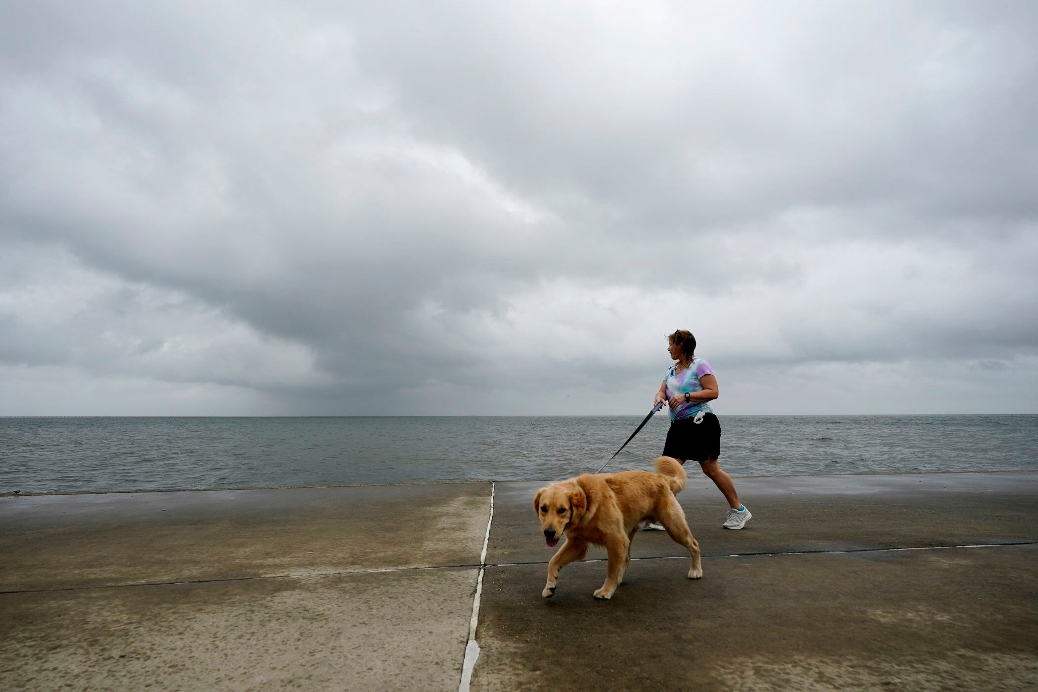
Officials urged people to take precautions and prepare to shelter in place, and a business-as-usual atmosphere in the morning in New Orleans diminished as the storm neared and grew stronger. Traffic slowed, and restaurants and coffee shops shut down.
“This year, the storms have been coming back-to-back. They’ve been avoiding New Orleans but finally decided to come,” cookie shop worker Curt Brumfield said as he stowed empty boxes in trash cans outside and others boarded up the windows.
The winds were picking up and water was rising above the docks in Jean Lafitte, a small fishing town south of New Orleans that takes its name from a French pirate. Workers drove truckloads of sand to low-lying areas where thousands of sandbags were already stacked for previous storms.
“We’re going to get a lot of water fast,” said the mayor, Tim Kerner Jr. “I’m optimistic regarding the tidal surge because of the speed of the storm, but we’re not going to take it for granted.”
Zeta could lash the northern Gulf Coast with wind, rain, and storm surge more than 150 miles (241 kilometers) east of New Orleans. In Mississippi, the city of Pass Christian ordered all boats out of the harbor, and Dauphin Island, Alabama, shut off water and sewer service in areas that typically are swamped in storms.
New Orleans officials announced that a turbine that generates power to the city’s aging drainage pump system broke down Sunday, with no quick repair in sight. There was enough power to keep the pumps operating if needed, but little excess power to tap if other turbines fail, officials said.
Officials said they were running through contingencies should there be other equipment problems. Forecasts called for anywhere from 2 to 6 inches (5 to 15 centimeters) of rain to fall in the New Orleans area, but Zeta’s pace could mitigate the flood threat.
By Wednesday afternoon, Zeta’s top winds had risen to just shy of a major, Category 3 storm, according to the U.S. National Hurricane Center.
On Tuesday, Zeta raked across Mexico’s Yucatan Peninsula, toppling trees and briefly cutting power to more than 300,000 people but causing no deaths.
It then regained strength over the Gulf of Mexico along a path slightly to the east of those of Hurricane Laura, which was blamed for at least 27 deaths in Louisiana in August, and Hurricane Delta, which exacerbated Laura’s damage in the same area weeks later.
Hurricane warnings stretched from Morgan City, Louisiana, to the Alabama/Mississippi state line, including Lake Pontchartrain and metropolitan New Orleans.
The deteriorating weather prompted early voting sites to close for hours in the western Florida Panhandle.
Tropical storm warnings were issued for a large swath of the South, from Louisiana and Mississippi into Alabama and Georgia, including all of the Atlanta area, where winds could gust up to 55 mph (89 kph) early Thursday. Winds could be “especially severe” in the southern Appalachian Mountains, where flash flooding is possible, the hurricane center said.
Large school systems in Georgia and South Carolina planned to close Thursday.
Edwards asked President Donald Trump for a disaster declaration ahead of the storm. He and Alabama Gov. Kay Ivey both declared emergencies, as did Mayor Andrew “FoFo” Gilich in Biloxi, Mississippi. Trump declared an emergency for Louisiana Tuesday evening.
An average season sees six hurricanes and 12 named storms. This extraordinarily busy season has focused attention on climate change, which scientists say is causing wetter, stronger, and more destructive storms.
After Hanna, Isaias, Laura, Sally, and Delta, Zeta will tie a record set in 1886 and repeated in 1985 for six hurricanes smacking the continental U.S., according to Colorado State University hurricane researcher Phil Klotzbach.
And as the 11th named storm to make landfall in the continental U.S., Zeta will set a new record, well beyond the nine storms that hit in 1916.
“I’m physically and mentally tired,” a distraught Yolanda Lockett of Lake Charles, one of about 3,600 evacuees from Laura and Delta still sheltering, said outside her New Orleans hotel.
___
This story has been corrected. The New Orleans emergency director's surname is Arnold.
___
Plaisance reported from Laffite, Louisiana, and Santana from Shell Beach, Louisiana. Associated Press contributors include Gerald Herbert in New Orleans; Jay Reeves, in Birmingham, Alabama; Melinda Deslatte in Baton Rouge, Louisiana; Seth Borenstein in Kensington, Maryland, and Gabriel Alcocer in Cancun, Mexico.
Updated on October 28, 2020, at 6:00 pm ET with new details