*By Carlo Versano*
Hurricane Michael made landfall Wednesday as a monster Category 4 storm with winds near Category 5 status. In the process, it became the most powerful hurricane to hit the U.S. mainland in nearly 50 years.
Washington Post weather editor Jason Samenow told Cheddar Wednesday he was tracking confirmed gusts of 130 mph and was deeply concerned about the storm surge and the potential for flooding.
"We're far from done with this storm," he said.
Michael's eyewall came ashore near Mexico Beach, Fla., just outside Panama Beach on the Panhandle.
Even once the storm weakens over Florida, large areas of the southeast that are still recovering from Hurricane Florence will be at great risk of serious flooding. The saturated Carolinas could see three to six inches of rain, and the winds will expand as the storm unwinds.
Reports of damage in the Panhandle area were beginning to come in as of Wednesday afternoon. Hours after the official landfall, the storm has not weakened substantially.
Although Michael is the second major hurricane to make U.S. landfall in roughly one month, Samenow said, "This has been a fairly normal hurricane season."
For full interview [click here](https://cheddar.com/videos/all-eyes-on-hurricane-michael).
The World Health Organization's cancer agency has deemed the sweetener aspartame — found in diet soda and countless other foods — as a “possible” cause of cancer, while a separate expert group looking at the same evidence said it still considers the sugar substitute safe in limited quantities.
More than a third of Americans were under extreme heat advisories, watches and warnings Thursday as a blistering heat wave that's been baking the nation spread further into California, forcing residents to seek out air conditioning or find other ways to stay cool in triple-digit temperatures.
Tourists in central Athens huddled under mist machines, and zoo animals in Madrid were fed fruit popsicles and chunks of frozen food, as southern Europeans braced for a heat wave Thursday, with a warning of severe conditions coming from the European Union’s space agency.
A new study published in Nature has found that more than 56 percent of the world's oceans have changed color in the past 20 years, and climate change is to blame.
Recently discovered teeth of a two-million-year-old human relative in Africa could give researchers new insight into genetics.
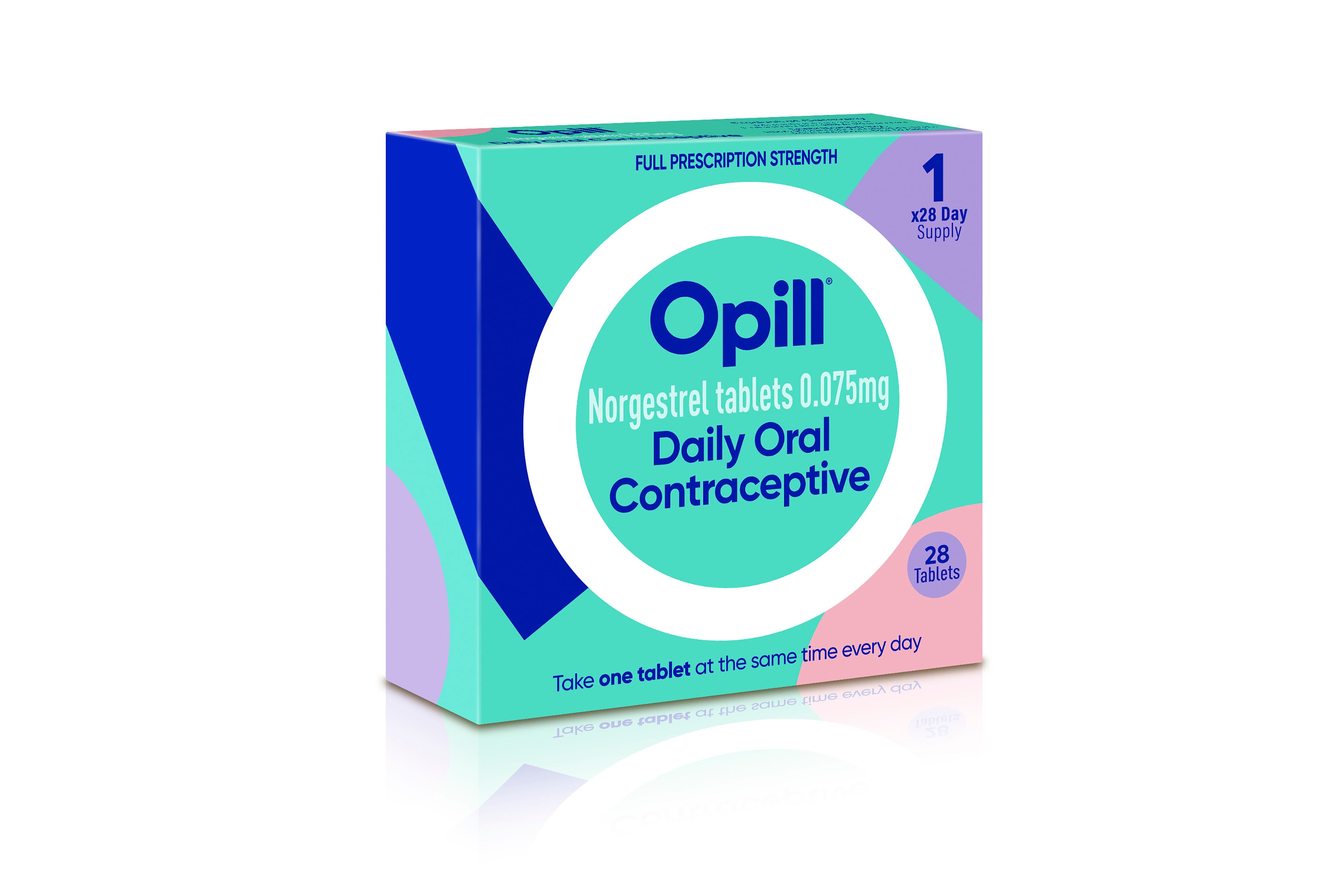
U.S. officials have approved the first over-the-counter birth control pill, which will let American women and girls buy contraceptive medication from the same aisle as aspirin and eyedrops.
The Webb Space Telescope is marking one year of cosmic photographs with one of its best yet: the dramatic close-up of dozens of stars at the moment of birth.